Coboconk, Gull River, Silver Lake, and Eastern Shore of Indian Point
Route Overview
Difficulty: Easy
Distance: 10km round-trip south from launch point here along eastern shore of Indian Point to old scout camp located approximately here.
Portages: None
Shuttle Info: Not required
What’s in a Name?
The Trent-Severn Waterway has no shortage of poetically-named communities lining its banks from Scugog to Omemee, Bailieboro to Buckhorn, but my favourite of all is Coboconk. I’m hard-pressed to think of another place in the world that contains more alliteration in one name!
But the euphony of its name isn’t the only thing “Coby” has going for it: not only is it home to the world’s smallest jail – now a local makers’ market – but much more interestingly, it is Canada’s “freshwater summit” since the town sits on the highest body of fresh water in the country from which you can navigate all oceans. Now if that doesn’t give you a good reason to dip a paddle there, nothing will!
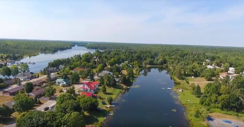
Mapping the paddling route that leads from Coboconk, down the Gull River, through nearby Balsam Lake and onwards through the Trent-Severn Waterway and around the world could keep a paddler busy for an afternoon or ten, but enjoying the paddling opportunities that this town offers doesn’t require nearly that amount of ambition. Coboconk is basically an island in the Gull River, and includes at least two lovely places to put in, with enough parking to make it easy for your group to find a place.
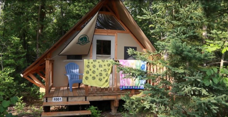
If you’re looking to stay nearby, Parks Canada has oTENTiks and small cabins available to book at the Rosedale lock, about 10km south of Coboconk.
Paint & Paddle: The Group of Seven Connection
There’s some fascinating Canadian heritage to this stretch of the Gull River as well. This was a favourite plein air painting and paddling locale for J.E.H. MacDonald, one of the founding members of the Group of Seven painters who helped create a uniquely Canadian aesthetic with their oil on canvas inspired by the ruggedness of the natural landscapes of The Land Between and Algoma regions. Every year, J.E.H. MacDonald planned a canoeing and fishing trip to Coboconk with his son, and produced some of his lesser known work while his son fished along the banks. His 1918 pastoral “Gull River” was stolen in a high-profile art heist earlier this decade and has never resurfaced, but you can find the subject of the painting heading south from the town of Coboconk!
When I first heard of Coby’s Group of Seven connection, I snuck away with my canoe for an exploratory paddle. I wanted to find a good place for more plein air painting excursions with the folks who join our paddling programs. I launched from the Coboconk Community Centre on the northeast side of Highway 35, and paddled north under the bridge towards Silver Lake.
This was a very different aspect of the Gull River than I’d paddled before at the rip-roaring rapids of the white water preserve farther upstream. Its waters are placid and inspiring, even just a short paddle from the townsite, and I found myself in expansive thought on the nature of artistic experience, and the wider spiritual benefits of painting and paddling.
The sunset paddle to Silver Lake was lovely, and in the absence of any wind or boat traffic I managed the 5 kilometer return trip in just over an hour. Nevertheless, I hadn’t found what I was looking for: a place along the route to pull over and imaginatively connect to the Canadian art history this place helped bring to life.
While scouring the maps and laying out a plan for the hidden gems of the Trent-Severn Waterway, Coby came to mind for its quaint townsite with multiple easy access points to the Gull. While tracing my finger across the long undeveloped shoreline of Indian Point Provincial Park, I realized the painting spot I was looking for wasn’t north of town, but to the south! We made a family plan for another exploratory trip.
Travel Info
The Route South
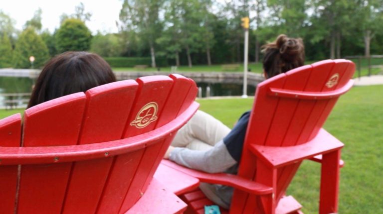
This time, we dropped in at the Public Access Boat Launch at the foot of Victoria Street: there’s nice parking space there, a dock there decorated with two red Parks Canada “Kawartha Chairs” and a nice space for getting the little ones ready. This is a beautiful spot to take a photo and #ShareTheChair to show some Parks Canada love! We launched our 17” Langford there for a lovely afternoon exploring the unsupervised and completely undeveloped eastern shore of Indian Point Provincial Park. The peninsula extends from the townsite deep into the heart of Balsam Lake, creating the characteristic twin wingtip appearance of the northern end of the lake.
Consisting of low-lying limestone shelf, the lakeshore property of Indian Point Provincial Park contains alvar topography. Alvars are a globally-rare ecosystem characterized by very thin or no soil over a mantle of limestone bedrock, and they support a host of increasingly rare species, including many endangered birds, such as the loggerhead shrike. Ontario is home to over half of the world’s remaining alvars, including the famous Carden Alvar Formation, of which Indian Point is a part.
From the water, the shoreline forms into an increasingly dense wetland hosting bittern and heron as well as migratory songbirds. At the land, a shallow escarpment pops up out of the water hemmed with cedar and white spruce, thinning to upland red oak and maple punctuated by towering white pine, to remind you that this is the unique “Land Between” the St. Lawrence Lowlands and the Canadian Shield.
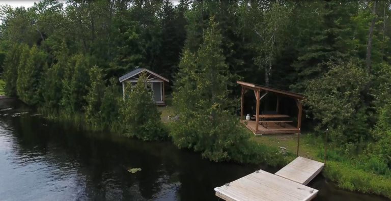
We stopped at a traditional boy scout camp for a shoreline snack of coffee and pastries from Nanna’s Diner and basked in the late-summer sun. While laying out after refreshments, we imagined J.E.H. MacDonald and his young one picking their way along the same shoreline, hunting for the perfect little fishing hole and placement for his painting easel. When the little ones finally maxed out their bandwidth for the excursion, we called it a day and returned to the pull out. Thankfully, the Gull’s Nest restaurant is within walking distance of the boat launch on the west bank and has a riverside patio that calls out for cold drinks and cups of Kawartha Dairy ice cream.
For help planning your trip, click here to contact Kawartha Lakes Tourism.
Click here to learn more about the Trent-Severn Waterway, National Historic Site of Canada.
Unless otherwise noted, photos and video by Justen Soule.
